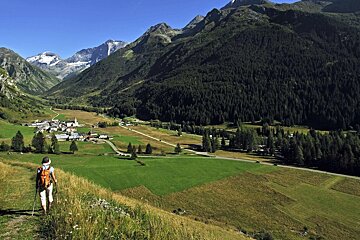
© P.Royer

Hiking Routes in La Plagne & the Paradiski
With a range of challenging and easier hiking routes in La Plagne you can head out on the mountain and explore the mountains and take in the picturesque views.
There are various mountain guides who will lead you on your hike or you can choose to tackle the trail or route on your own but just make sure you are fully equipped, prepared and have all the full details before setting off.
Below are a selection of some of the suggested hiking routes in La Plagne. There are many more to choose from so head to our map page for lift maps or pick up a guide or map from a Magasin or Information point to explore some of the other routes.
Hike 1 - Presset lake and refuge
Starting point: St Guerin chapel car park
Distance: 14km
Set off from the car park and follow signs to Refuge de la Balme. Once there take the path to the left in the direction of Refuge de Presset and the lake. The elevation gain is 900m, and you can take your dog with you as animals are permitted here. There is the possibility of continuing to Col du Grand Fond, which offers and additional 100m elevation gain. You can then return via the same route back to the car park. This route is rated as red (hard), so is for experienced hikers only.
Hike 2 - Glacier trail
Starting point: Laisonnay car park
Distance: 15km
Duration: 4h
From the car park take the road for about 300m, and after the bridge turn left onto the track which then goes right towards the Glière refuge (1,996m). From the refuge, retrace your steps to get back on the track that climbs to the chapel and the lake, on the left a fairly steep path rises up to join the track higher up. You will quickly reach the Plagne mountain pasture, passing below the Plan du Sel chalet where the mountain Beaufort cheese is made, the 'Prince of Gruyeres', with a registered designation of origin. Continue up the path that crosses under the Grand Plan chalet, the path continues to rise slowly up the Combe du Grand Plan (East) and goes straight under the Col de la Croix des Frêtes. This route is level blue, so it's suitable for beginners and hiking novices. With an elevation gain of 810m, the route is considered suitable for families hiking with children.